Data products
Most of our current and past projects have a spatial dismension and are accompanied by series of geographic data and maps. Published figures lack interactiveness and detail, which is why we present some of our results in this section - in form of web maps.
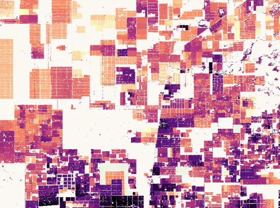
Agricultural frontiers in Chaco
We developed and mapped a novel set of metrics to describe archetypical patterns of frontier expansion in Chaco, pertaining to the speed, the diffusion and activity of deforestation, as well as post-deforestation land use.
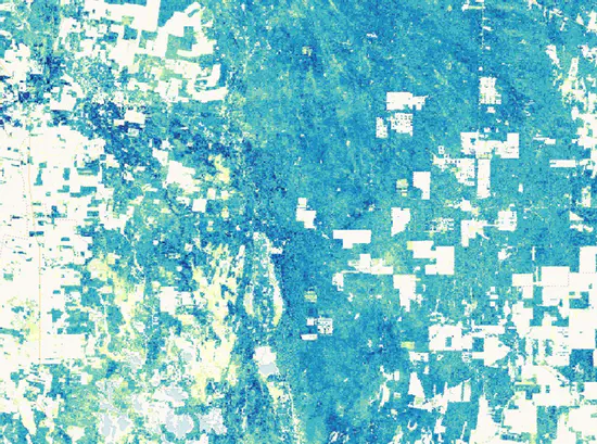
Chaco aboveground biomass
We used a Gradient Boosted Regression framework to test the relative gains of combining optical (MODIS) and radar (Sentinel 1) time series, as well as lidar-based (GEDI) canopy-height data, to map biomass in tropical dry forests of Chaco.
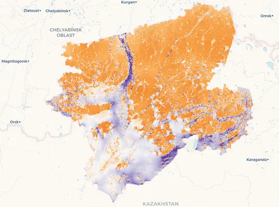
Rewilding in Kazakhstan
We mapped cropland abandonment, declining grazing pressure and rural outmigration in the steppes of northern Kazakhstan. Our aggregate human influence index can help create new protected areas in the steppe.
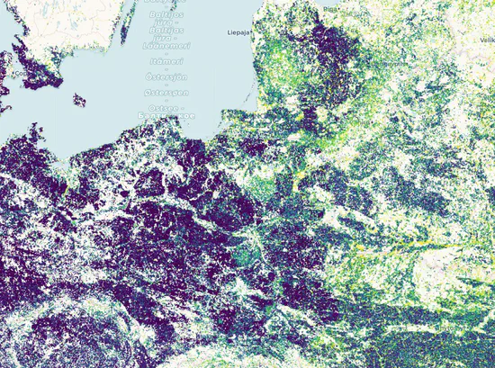
Farmland abandonment in Europe
Using the fallow/active time series based on MODIS Normalised Difference Vegetation Index, we mapped fallow frequency and hotspots of farmland abandonment and recultivation of unused farmland in Europe.